
Kiwi Rider Podcast 2022 | E28
In this week's show, Ray talked us through his insurance win, we have
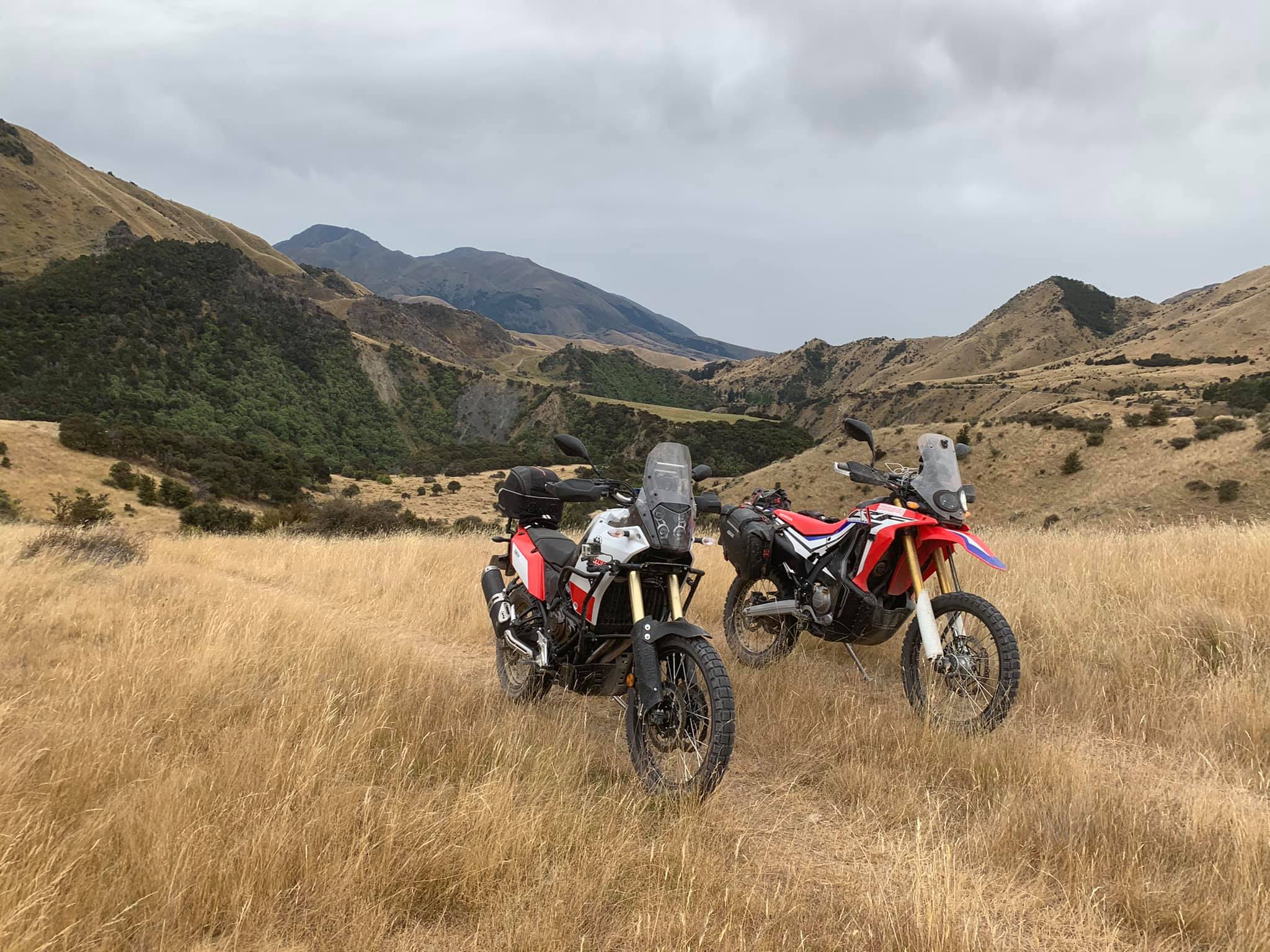
Also known as Acheron Road, the road down the center-right of the South Island of New Zealand from roughly Seddon to Hanmer Springs is, is one of the all-time great rides of NZ. Open from Labour Weekend to Early April, you can drive through on pretty much anything, though anything 7m long or towing, you'll need a permit. We've heard stories of people riding this road on road bikes, sports bikes and even the occasional Hog.
If you are looking for a great round trip route, couple the Molesworth with the Rainbow, click here for more info.
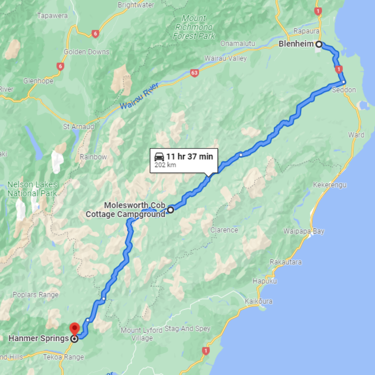
To make the most of your time, plan to leave from Blenheim, heading south towards Taylor Pass. this is a sealed road, but moderately twisty, and a great warm up with what is to come.
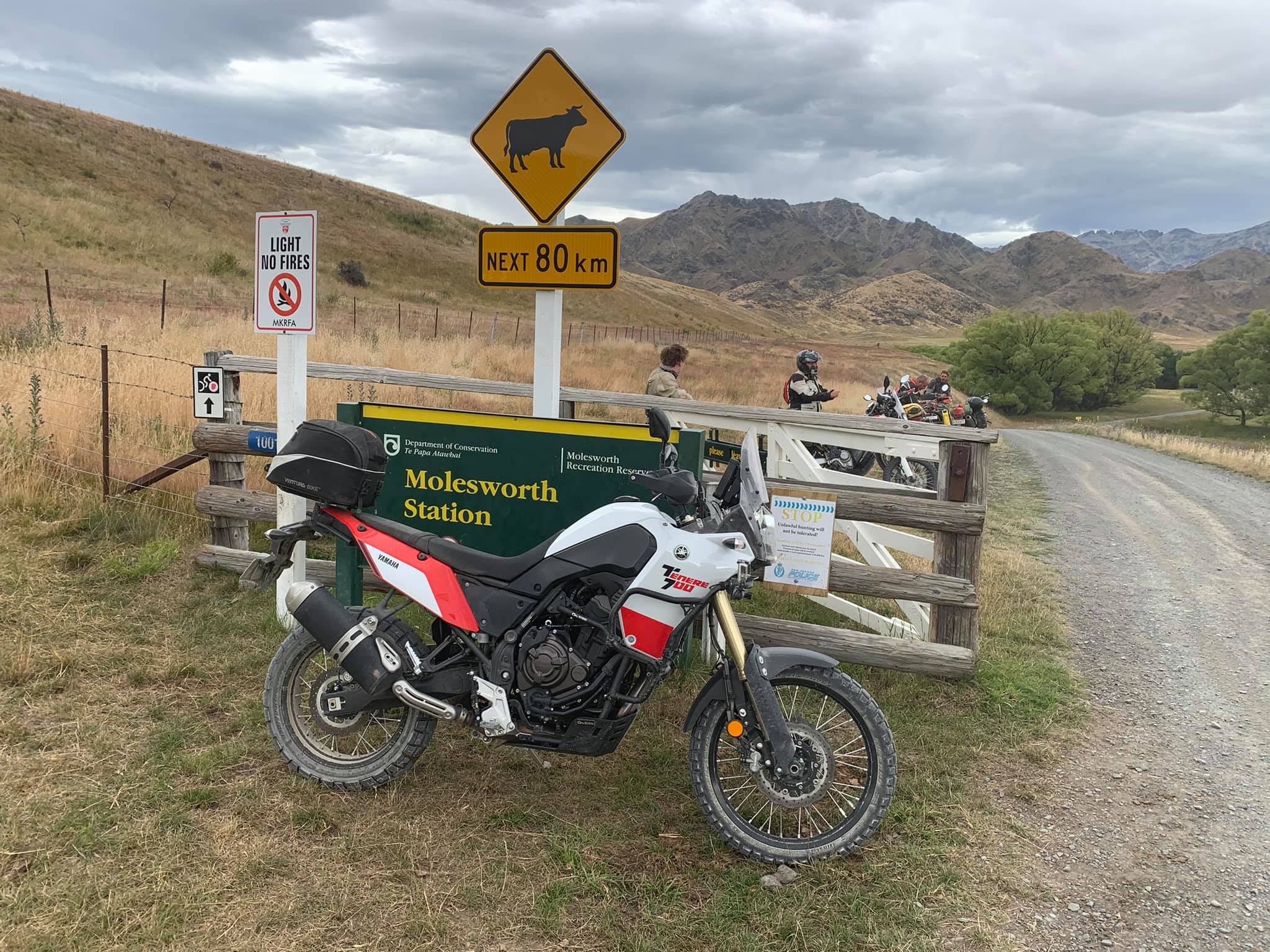
At the end of Taylor Pass Road, will pop out at the intersection of Awatere Valley Road, here you'll hang a right, and essentially follow your nose, and the Awatere River. Youll wind through tussock and farmland, past the Middlehurst station, eventually arriving at the Molesworth Cob Cottage and camping ground around 100 km from Blenheim. This is the start of "The Molesworth" proper.
Note: much of the following is taken from the doc.govt.nz website, distances are given from Blenheim to Hanmer Springs.
Wards Pass (131 km)
Crossing the flats from the cottage, look south towards the triangular‑shaped Dillon Cone (2174 m) and straight ahead to Barefell Pass, recorded by Frederick Weld in 1850 and still used for moving stock from the Awatere to the Acheron catchment. The road then climbs to Wards Pass (1145 m), closed by snowfalls for long periods.
As you drop from Wards Pass, you cross a section of Muller Station, courtesy of the runholders.
The 250‑hectare expanse of Isolated Flat is an outwash plain,bounded by the Awatere Fault.
From January until April, masses of tall, white gentian flowers can be seen growing amongst clumps of short tussock and pasture grass. Introduced blue borage (Echium vulgare) also grows profusely, the blue flowers attracting bees, which produce delicately flavoured honey for sale throughout New Zealand and are important pollinators for pasture plants, including clover.
The flood‑prone, braided bed of the Acheron River is a habitat for numerous bird species, including the nationally threatened banded dotterel and black‑fronted tern that breed in the area, as well as native fish species and trout.
Leaving the flat, the road climbs up and over Isolated Saddledown to the junction with the Tarndale track.
Here, the Severn River, which has a significant catchment starting on the Molesworth boundary, meets the Acheron River.
To the right of Alma Valley is Mount Augarde. From here, looking down the Alma Valley you can see the routes to the upper Wairau and Tarndale, where cattle spend summer after calving. The Tarndale turn‑off (no public access up this track) leads to the historic Tarndale Homestead, built from cob in 1874 and still used by stock workers.
On the opposite side of the Acheron is the confluence with the Guide River, important for stock movement between the Awatere and Acheron Valleys leading up to Barefell Pass.
Pig Trough Suspension Bridge is one of three built by the New Zealand Electricity Department in the early 1980s to provide access to towers where the high‑voltage direct-current line crossed the river away from the road.
The other two bridges have been washed away in floods. The unusual name comes from the wild pigs often seen around a wet soak near the head of the gully named Pig Trough Gully. A toilet, shelter and information panels are located here.
Lower Acheron Suspension Bridge is a historic stock bridge built in 1945 by students from Canterbury University’s Engineering School. It was built to replace an older, dilapidated bridge. It is a remnant of the old sheep farming days when St Helens Station had to periodically move up to 15,000 sheep safely across the Acheron River. It is now maintained by the Department of Conservation as a historic bridge.
At the confluence of the Acheron and Clarence Rivers, the Acheron Accommodation House is the oldest building on Molesworth.
This original road to Hanmer is now suitable only for 4WD vehicles. Cattle leaving Molesworth from the southern end are driven over Jollies Pass from the Clarence Valley and trucked from Landcorp’s bull farm at Hanmer.
Jollies Pass was once the social centre of the district, boasting a store, unofficial Post Office and hotel.
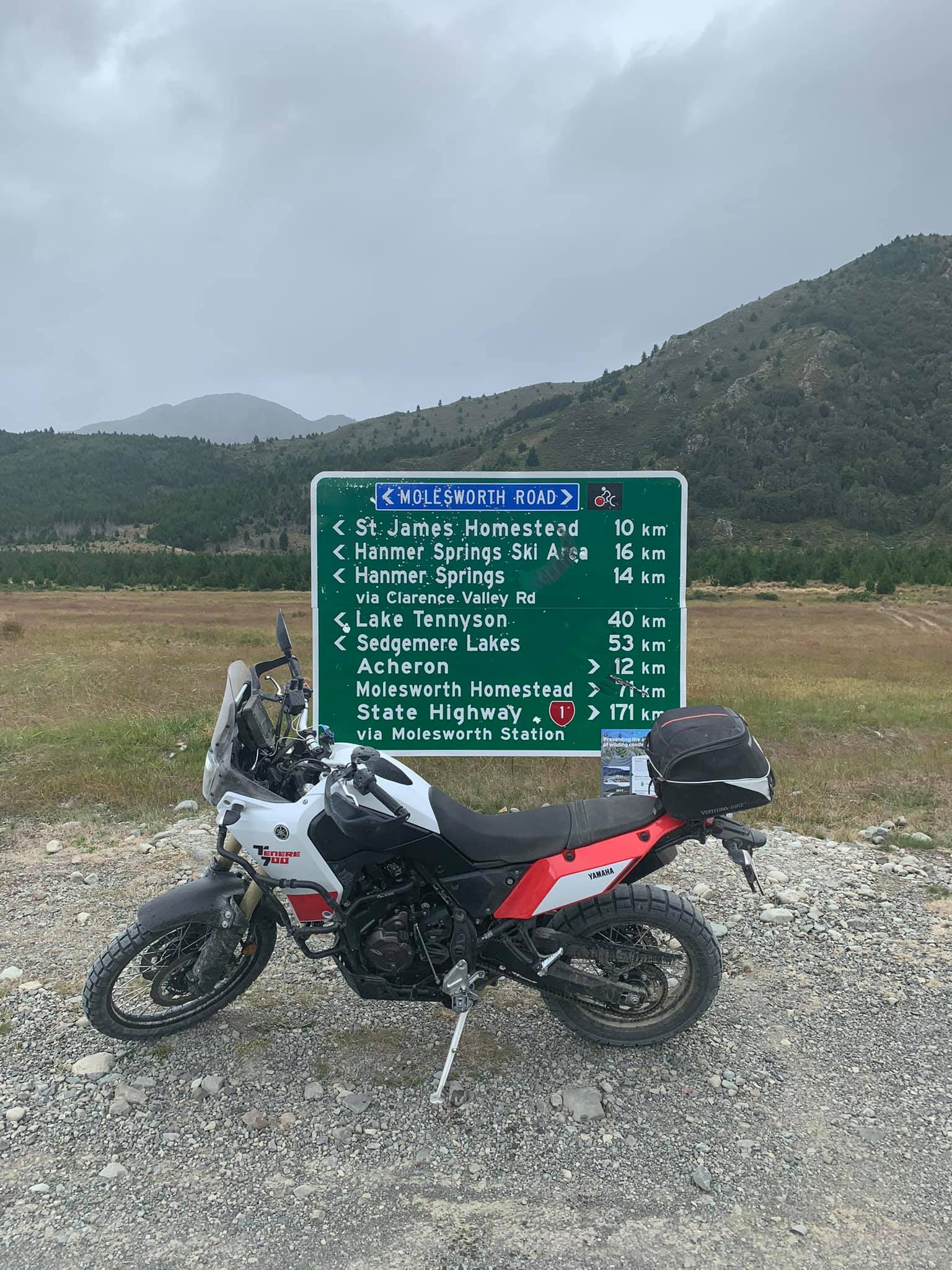
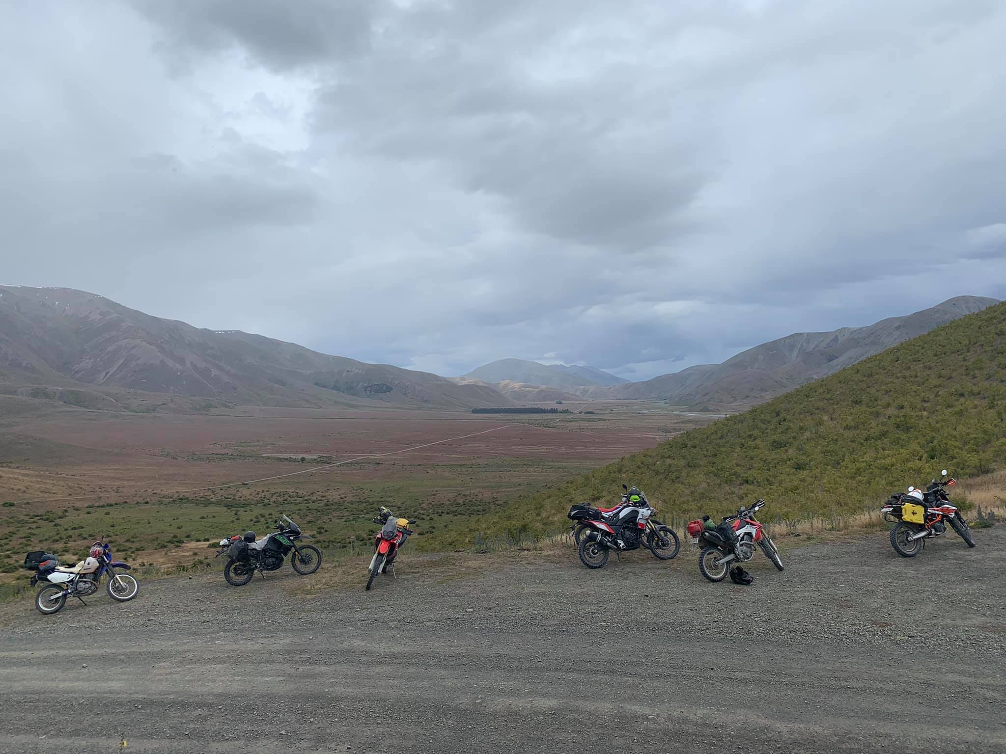
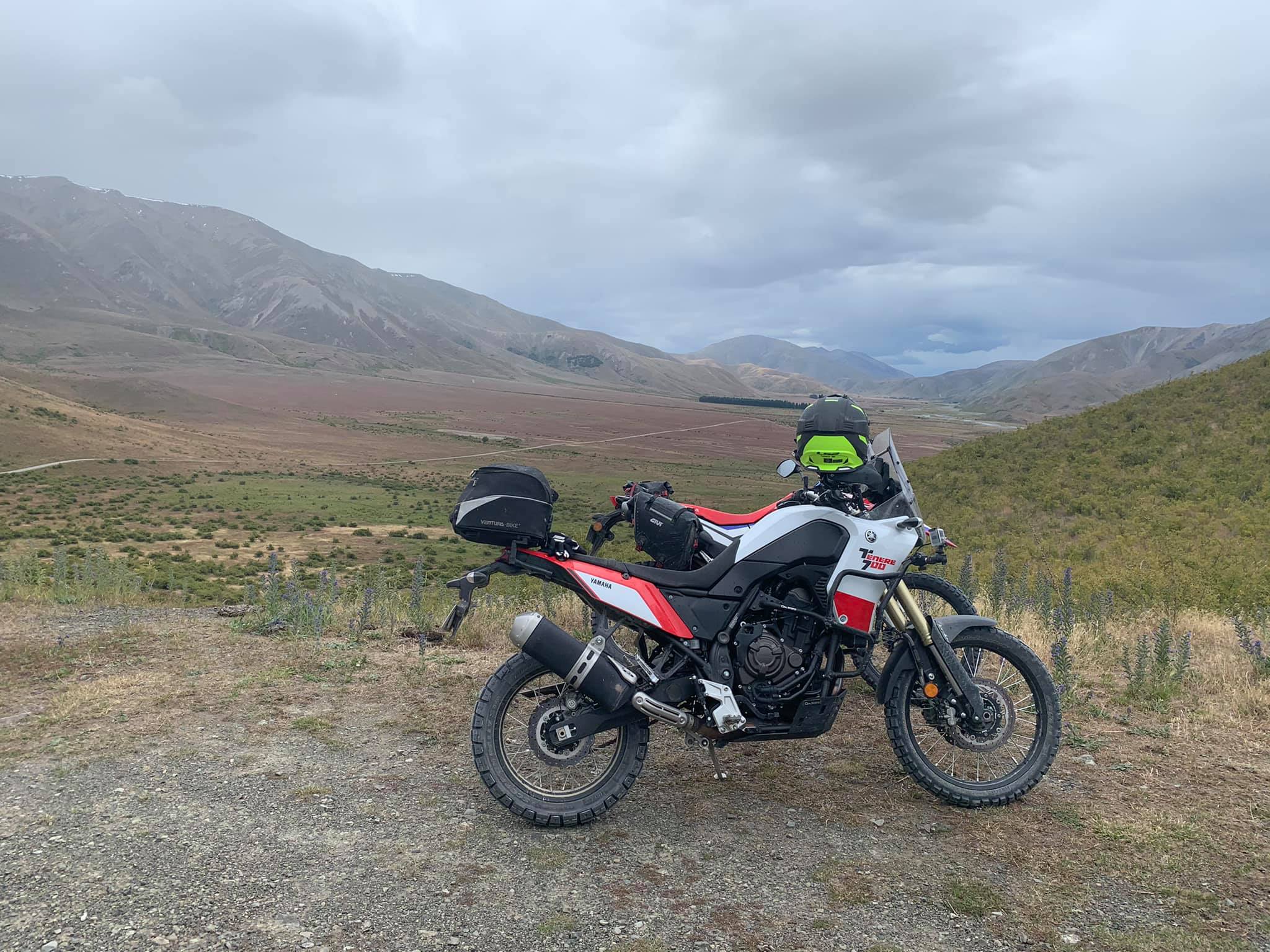
Jacks Pass/Rainbow junction (199 km)
Here, the main route to Hanmer turns left, heading over Jacks Pass and into town. The Hanmer to St Arnaud Road turns off to the right.
Below is a series of podcasts, of which episode 2 was recorded live during our trip down the Molesworth, early 2021.